

No Environmental Impact Statement
This is a project that I have been wanting to do since last year. Many of us had questions about why “B. Safety and Environment” (i.e. environmental impact statement) is often marked “no” on the weather modification reports submitted to NOAA. This lack of information led to following up with DEQ and finding that no testing is completed for Idaho’s ongoing cloud seeding particulate release. It became clear that someone needs to fill this data gap. A common assurance repeated to the public is “the data shows” that this program is safe. Is that claim acceptable when a complete data set is not provided? You can’t find what you refuse to look for.

The questions remained:
Can the cloud seeding target areas adversely impact the surrounding vegetation?
Who is monitoring the environmental impacts?
Are firefighters made aware of liquid propane tanks used for cloud seeding? And are those tanks checked and emptied before “fire season.”
And many more.
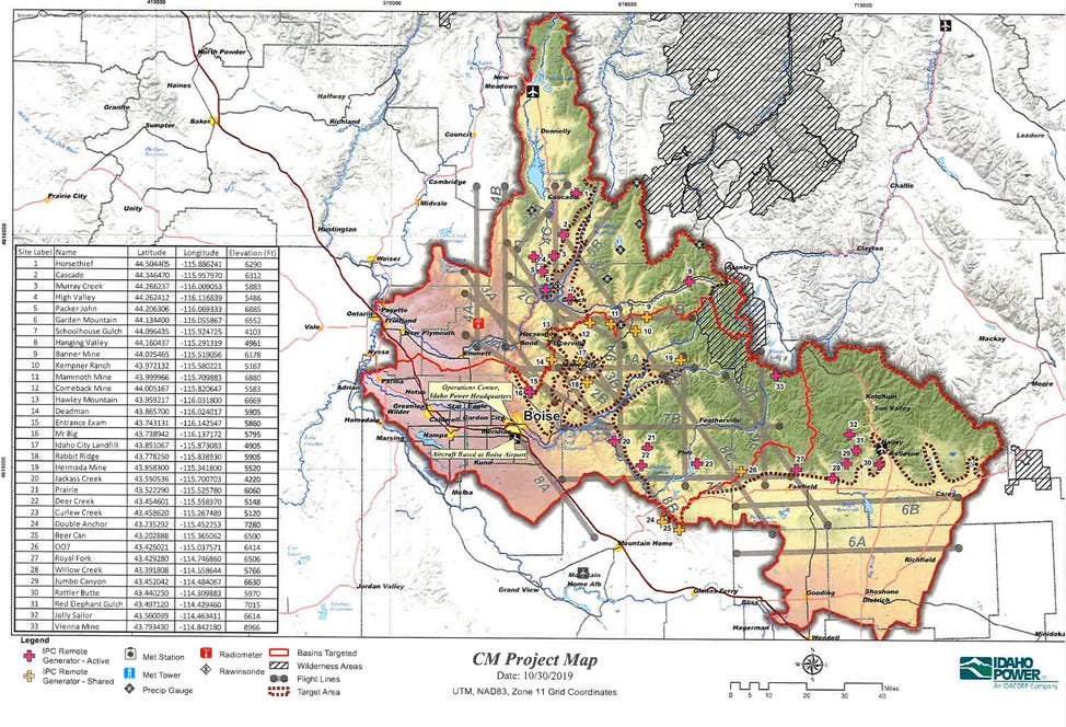
Coordinates made public, now hidden
Enter, old NOAA reports when Idaho Power once disclosed generator coordinates, NASA fire data tracking, and Google maps.
I give you the mapped coordinates of cloud seeding generators (blue icons) and NASA fire coordinates (red icons):

Data points were taken from the following sources:
NOAA weather modification reports from 2023 and 2021.
NASA FIRMS (Fire Information for Resource Management System).
https://firms.modaps.eosdis.nasa.gov/map/#d:24hrs;@0.0,0.0,3.0z
*Note that the above map is only Idaho. We know that Oregon has a cloud seeding project in the Blue Mountains in Pendleton/Umatilla County.
Map:

**Note also that the recent addition of liquid propane generators is not available on the older maps.
Google Map to Google Earth
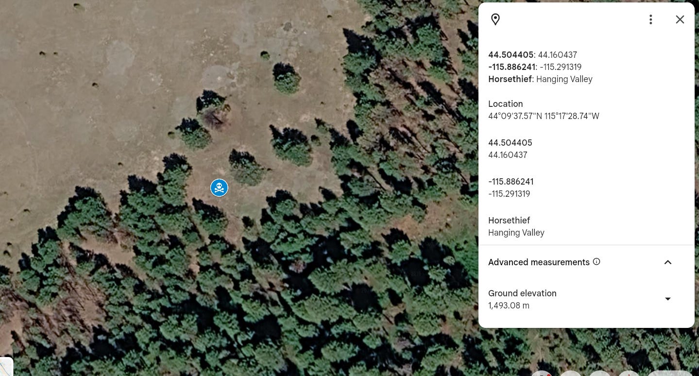
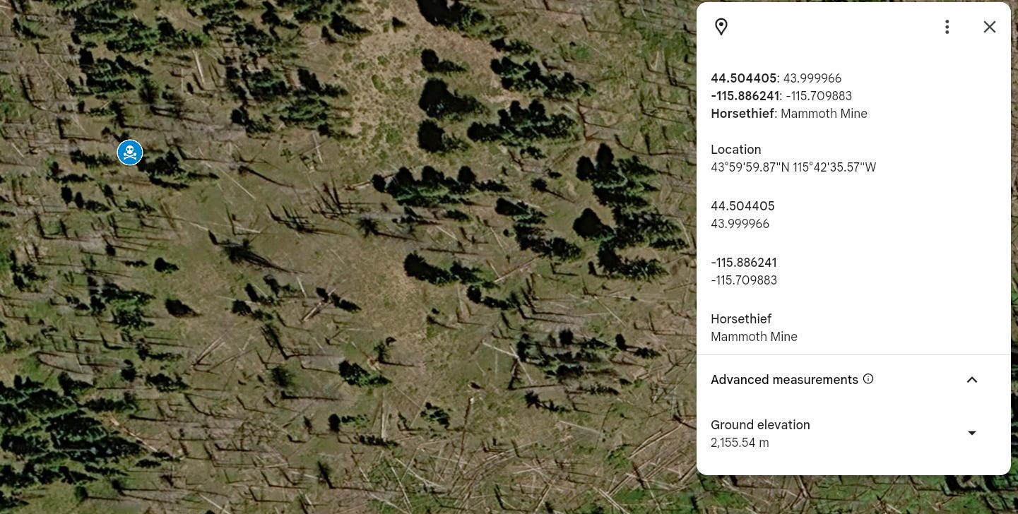
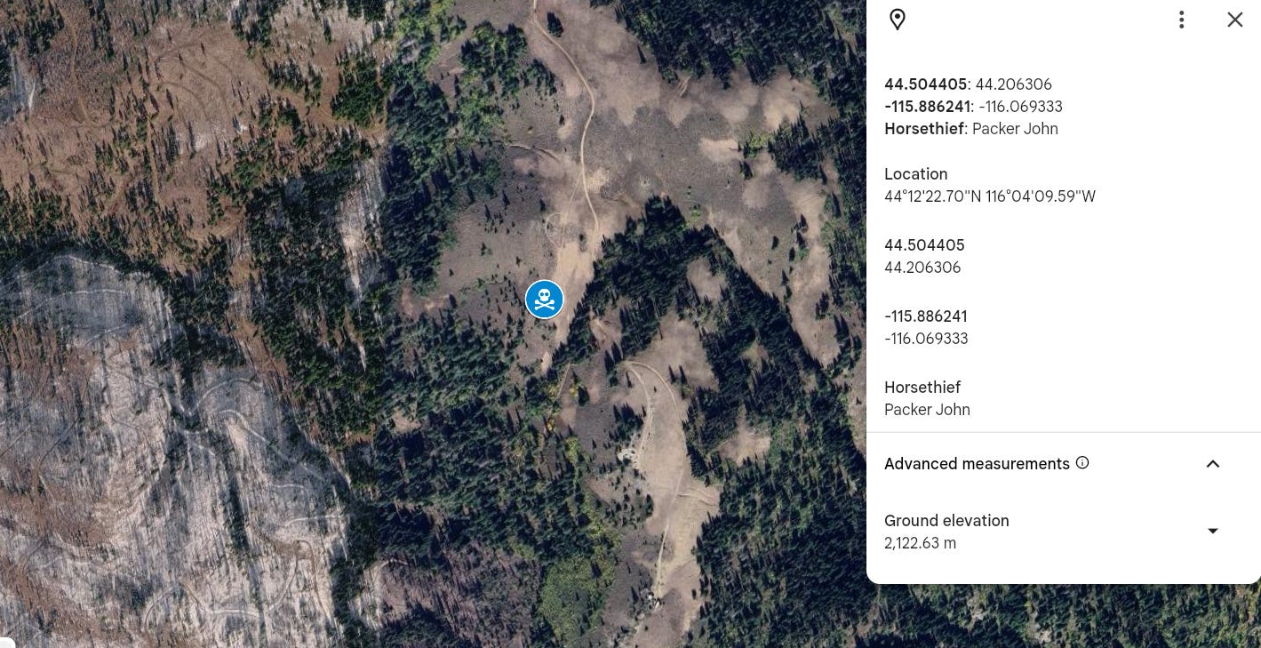
The Google map tool allows you to view the coordinates in Google Earth. Many of the cloud seeding generator sites seem to have dry or unhealthy vegetation. Residents gave firefighters these coordinates to help in their investigation into environmental impacts. This is a discussion worth having. How is cloud seeding impacting the ecosystem? Is a drying effect adding to fire fuels? Was the National Park Service correct in their early warnings of cloud seeding:
“We believe that the proposed weather modification program would have adverse impacts on the size, duration, intensity, behavior, spatial distribution, and ecological effects of fire.”
Use the google maps link to view these areas. Below are a few screenshots of generator coordinates and the surrounding area.
Federal officials
Recent headlines show that Idaho fires have drawn federal attention. Hopefully they are provided all the data and investigate the possible correlations.
Federal officials tour Idaho fire sites following significant Western wildfire activity
The Big Grass Fire, burning across southern Idaho, Oregon and nearing the Nevada border, is now the biggest active wildfire in the contiguous United States as of Aug. 11. It’s one of hundreds of wildfires burning throughout Idaho and neighboring western states that has prompted concern from residents following a difficult, light snowpack season that left the state less prepared for the summertime.
Closing thoughts
The stated purpose of the cloud seeding program is to increase precipitation. The result is light snowpack, according to reports. The environmental impact statement is not provided to the public, which leads to more questions about transparency. I am not making any accusations but closing the data gap the cloud seeding proponents seem comfortable leaving wide open.
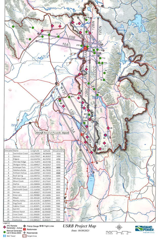
Edit to add screenshots of the old NOAA reports in the event that they are taken off-line. Generator coordinates were pulled from publicly available reports within the NOAA weather modification database.
This is amazing work! We hope you will share it with powers that be up and down the cloud seeding and wildfire chain. They need to see(d) this!